Mount Ranier, Glacier, Yellowstone and Grand Teton National Parks are billed as the highlights of Trailfinders From Glaciers to Geysers fly-drive trip, guaranteed to astound with majestic mountains, turquoise glacial lakes and magical forests. But between these protected areas of outstanding beauty, along the tour companies planned route, are some lesser-known gems to explore, offering adventure, history and escape from the car on a driving day.
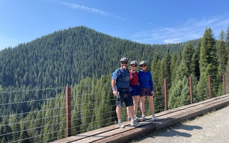
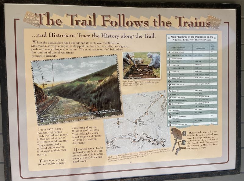
Riding the Route of the Hiawatha, a 15-mile bike trail with a series of 9 tunnels and 7 trestles in the breathtaking Bitterroot Valley, is one such exhilarating pit stop. Located 70 miles west of Coure d’Alene between Seattle and Glacier National Park, the trail follows the glorious Milwaukee Road, a section of railway operated from 1909 to 1980 by Chicago, Milwakee, St Paul and Pacific Railroad, connecting The Windy City to Seattle and Tahoma in the west. In its heyday, the segment of track was revered as one of the most scenic sections of the railway in the US and today the route joins New York’s The High Line in the Rails to Trails Conservancy Hall of Fame on account of its stunning setting, historical value and family- friendly activities.
If initially you’re thinking it sounds like a lot of effort, think again – the going is largely downhill, and most riders can leisurely cruise the distance in 2.5 to 3.5 hours. Shuttle buses at the end of the ride whisk cyclists back uphill in around 30 minutes, so it’s accessible for a wide range of abilities, with thrills kicking in from the get-go.
Sunglasses off and headlights on, from the trailhead cyclists nose straight into St. Paul Pass Tunnel (or Taft Tunnel) and the longest on the trail at 1.661 miles long. All year round, it averages a cool 7 degrees Celsius as it bores a path through the Bitterroot Mountains, crossing the state line from Idaho to Montana – and it’s extremely dark.
Travelling through the pitch black with only a thin pool of light from a bike torch is both eerie and exhilarating. Echoes reverberate against the tunnel walls, but it’s challenging to see anything more than a few feet away when deep underground, even with the aid of the torch beam. With limited visibility, participants should watch out for oncoming cyclists and potential pedestrians travelling without illumination.
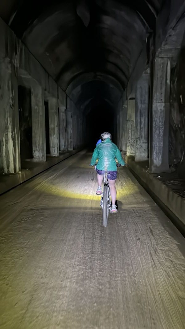
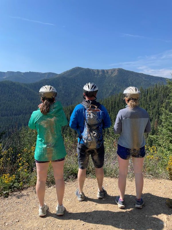
Queue, a top tip for riders: switch off lights when exiting the tunnels to conserve battery life for the later passageways. Top tip two: wear old gear. Water seeping into the tunnel creates limestone puddles resulting in a splashy journey, so cyclists, prepare to get dripped on and emerge looking like a skunk – back in the sunshine, clothes soon dry.
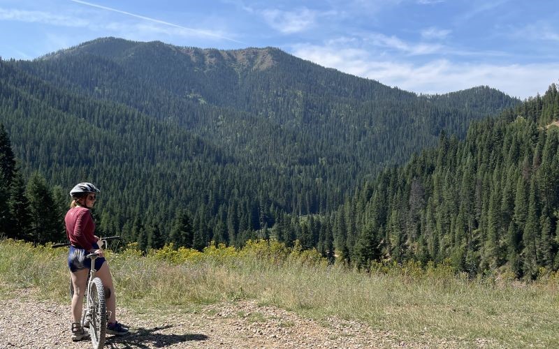
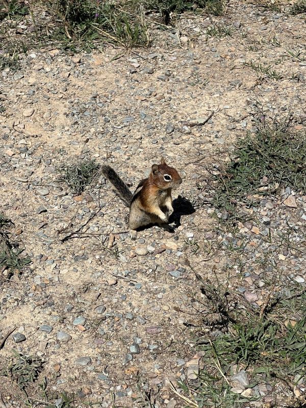
Exiting St Paul Pass Tunnel, a pretty waterfall cascades down the rocks for a perfect photo opportunity, and jaw-dropping scenery is revealed. A glimpse of the sky-high trestles nestled amongst the pines of the thick forest is awe-inspiring and anticipation builds of what’s yet to come. While speed demons can bomb down the hard-packed dirt track, those with time to spare should take advantage, as this is one trail that deserves to be savoured. With immense 360-degree views, the slower and quieter you navigate the path, the higher the chance of spotting wildlife – deer, elk, moose and bears all inhabit the area.
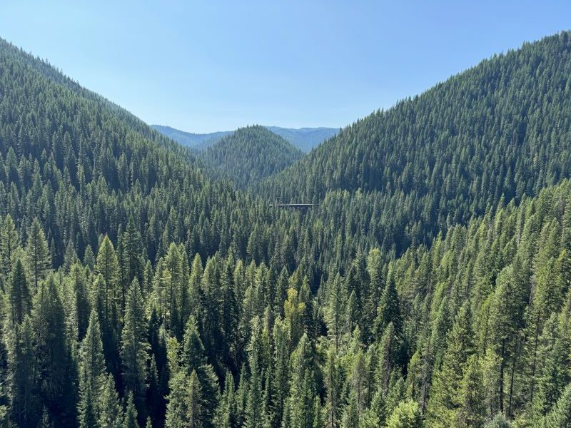
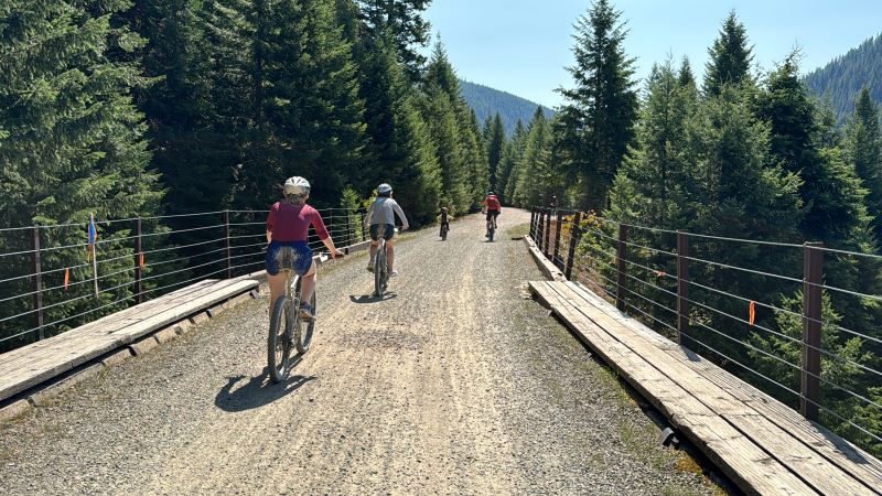
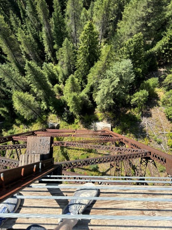
However, eye-balling animals on this excursion is a bonus and not the main attraction on offer. With eight more tunnels to navigate and seven trestles to send heads spinning, getting up close to bears can wait until the national parks. Built to carry steam engines, the bridges are plenty wide to cross comfortably without needing to look down, so acrophobic riders shouldn’t discount having a go – stick to the middle and glide on over. For the more adventurous, gazing deep into the valley from lofty elevations (Clear Creek Trestle at 220ft is the tallest) makes the knees quiver but is simply magnificent.
Between the trestles and the tunnels, take a break from cruising to read information boards (there are 47 in total) dotted along the length of the trail. Colourful tales of fights, murders, and ‘women of the underworld’ reveal the brutality of life for early 20th-century railway workers in the backcountry. While details of the devastation wreaked by forest fire in 1910 expose the dangers lurking within the incredible landscape.
Tonnes of natural beauty spots are present along the way to pull over and have a snack, with picnic benches and restrooms at the East Portal trailhead, two locations along the track and Pearson where the trail ends.
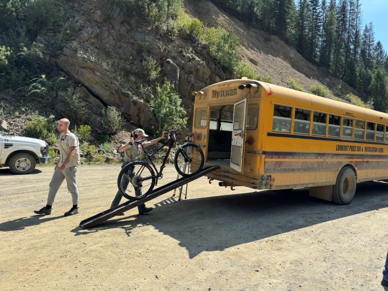
While it’s possible to cycle back to the car via NF 506, a dirt/gravel mountain road or by retracing the Route of the Hiawatha, most travellers dismount at Pearson. Iconic yellow school buses adapted to transport bikes in the rear for the bumpy journey uphill to Roland operate daily from 11am to 4:15pm in peak season on a first come-first served basis, but be prepared to queue (average queuing time is 45 minutes). From the drop-off point, east of the trailhead, cyclists pedal back through St Paul Pass tunnel to the start. Wet and dirty yet again, it’s wise to have a change of clothes to hand before climbing back into the car for the onwards journey.
To ride the Route of the Hiawatha, head to the Lookout Pass Ski Area, off Exit 0 on the I-90. Here you can purchase tickets and hire bikes, helmets, lights and a packed lunch if you need one (it’s not possible to purchase food between East Portal and Pearson). If your vehicle is not suitable to transport bikes to the trailhead (30-minute drive from Lookout Pass), the operators will deliver your equipment to the starting point at East Portal for an extra charge. You can ride the trail without pre-booking, but during peak season (8 June – 1 September) it’s advisable to book ahead online at least 48 hours in advance. Bikes and accessories can then be delivered to the trail head by 8:30 in the morning, where you can pick them up along with the trail ticket for speedy access, beating the crowds. It also saves a few dollars.
A pre-booked trail ticket and shuttle pass costs $35, standard bike rental is $40, while lights and helmets come in at $12 apiece. Trail tickets are essential to access the route and must be displayed on bike handlebars; this goes for those using their personal bikes too.
To avoid the crowds, arrive early or later in the day, avoid school holidays and midweek is also a good option. And finally, leave your pooch at home. Dogs are not allowed on the trail.
Covering over 2,000 miles, there’s a fair amount of motoring in the 16-day Trailfinders itinerary, but those taking the short detour off I-90 will be rewarded with a jewel of an afternoon or morning. With legs stretched, rears bashed, and faces sun kissed – you can hit the road satisfied to have maxed out the day’s journey and refuel with a choc-chip cookie.